Drone Roof Inspection in Bellingham, WA
Drone roof imaging for large or hard-to-reach commercial roofs in Bellingham, WA, with mapped photos, defect callouts and airspace planned before the flight.
Drone Roof Inspection in Bellingham, WA
Drone roof imaging for large or hard-to-reach commercial roofs in Bellingham, WA, with mapped photos, defect callouts and airspace planned before the flight.
Commercial Roofing Services
Drone Roof Inspection in Bellingham
A roof nobody can safely walk still has to be priced. That is the job a drone does. In Bellingham, WA, where a wet deck and a slick membrane make a walk-down slow, a flight over a large roof returns hundreds of overlapping images in the time a crew needs to rig a ladder. The images show seams, ponding, damaged flashing and missing caps before anyone sets foot on the surface.
The drone does not replace the hands-on check. It tells us where to spend that time. Findings from the flight go onto a plan, and the crew walks only what the images flag.
Overview
Drone Roof Inspection
When a drone makes sense
Three conditions call for one. The roof is very large. Access is limited or unsafe. Or the schedule cannot wait for a full walk. A drone also suits bid-stage reviews, where a general contractor needs a condition picture before drawings are final.
It is a poor fit for small, easy roofs, and for any finding that needs touch. A lifted lap, a soft spot or a failing sealant bead often has to be pressed, probed or scraped to be confirmed. So we treat the flight as the first pass and the walk as the second. The bid shows both as separate lines, and the owner can decide whether the second is needed.
Timing matters too. Sunshine in Bellingham totals about 1,866 hours a year, so clear windows are worth using. A dry roof photographs better, because standing water and wet patches hide seam lines. We aim for the first dry day after rain, once the surface has lost its sheen but the moss lines are still visible. Those lines mark where the roof held moisture longest and help us pick the places the second pass should check.
What the flight captures
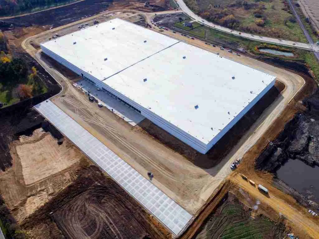
A flight runs in a grid at a set height, so images overlap and every point on the roof appears more than once. Those frames stitch into a single map of the roof at a resolution fine enough to read a seam. Oblique passes along the edges show coping caps, parapet faces and base flashing from the angle a person cannot get.
We then close in on suspect areas. Close shots of a split seam, a cracked boot or a scupper stuffed with moss go in the report, each with a location mark. Rooftop equipment, drains and penetrations are counted and logged. The result reads like a plan with photos pinned to it, not a pile of files.
Measurements come from the same data. Parapet length, curb count and drain count can be taken off the map, which helps the estimator before the walk. Those quantities feed the bid lines for edge metal, flashing and penetrations. Quantities taken from imagery are checked on the roof before anything is ordered, since a drone sees plan view and not every vertical height.
Airspace and permissions
Flight planning comes before any visit. Bellingham International Airport covers 2,190 acres about three miles northwest of the city, and flights near an airport need airspace clearance before takeoff. Roofs in the airport industrial area and nearby north-side neighborhoods get checked for controlled airspace first. If clearance is not available, we say so and switch to a ground method.
Property permission is the second item. The owner or manager approves the date, the area and the safety zone. If a lender or buyer is waiting on the findings, the flight can be one of the first items on the schedule, since it needs no scaffold, no lift and no roof access crew. Tenants and customers should not be under the flight path. We schedule around store hours, shipments and events. Wind limits set the day, and Bellingham wind can close the window quickly.
Where it saves the most time
Wide industrial roofs benefit most. The Port of Bellingham operates Airport Industrial Park, Marine Drive Industrial Park, Fairhaven Marine and Industrial Park and the Bellingham Shipping Terminal. A flight across the Marine Drive and Squalicum waterfront can map a roof that would take a crew a long time to walk, which matters when the next dry morning is uncertain.
Retail is the second case. Bellis Fair, an enclosed one-story center of roughly 773,000 square feet, is ringed by big-box buildings. For any big-box roof, a drone pass lets us rank the areas before a crew goes up. The survey measures the roof itself, not the floor area under it.
What a drone cannot see
Images show the surface. They do not show what is beneath it. Trapped water in the insulation, a corroded deck and delaminated board are invisible to a standard camera. A thermal sensor can reveal temperature patterns that hint at moisture, but it needs the right conditions, and it does not confirm anything on its own.
For moisture questions, we pair the flight with an infrared and core-cut survey. The flight shows where to look. The cores show what is there. Skipping the cores risks a bid built on a guess. In a climate with 34.8 inches of rain a year and little sun to dry things out, that guess is expensive.
What you receive
The deliverable is a report. It holds the stitched roof map, numbered findings with close-up images, a short note on each and a priority mark. Repairs identified in the flight link to scope lines and prices. The raw images stay available for the building file.
The same imagery supports a hands-on inspection follow-up and, later, a comparison. A second flight after a storm or a repair shows what changed. That before-and-after record is useful in insurance work, since it shows condition at a known date. We keep the date and weather note on every set.
For owners with several buildings, the flights can run in sequence on the same day. That gives a consistent comparison across roofs, with the same camera, the same height and the same light. A property manager can then rank the buildings by condition and spend where it matters most. Roofs that look alike from the street often turn out to differ widely once the surface is mapped.
Commercial Roofing Questions
Does a drone flight replace a roof walk?
No. It narrows the walk. The flight locates suspect areas and records the whole surface, and the crew then confirms the findings by touch and probe. On a safe roof, the walk is brief. On an unsafe one, the flight carries most of the weight.
What weather stops a flight?
Rain, fog that hides the roof and winds beyond the aircraft's limits. Bellingham has a long wet season, so we hold a few alternate dates. A flat overcast day suits imaging well, because shadows stay soft and details show clearly.
Can the drone work over occupied space?
Yes, with planning. We keep the flight above the roof and clear of people below. Parking lots, entries and loading areas are marked off or avoided during the pass. The property manager approves the plan, including the time of day.
How fast do I get findings after the flight?
Processing takes the longest. Large roofs generate many images to stitch. We send the numbered findings and the map once that finishes, and any urgent defect, such as an open seam over finished space, is called in the same day.
Can you fly a roof I am buying but do not own yet?
With the owner's permission, yes. A condition report built from the flight gives a buyer or lender a view of the roof before closing. We need written approval from the property owner and any tenant who controls the roof.
Send the address, the roof size and the access limits
Tell us which roofs are wide or hard to reach and when you need findings. We will plan the flight, clear the airspace and return a mapped report.